

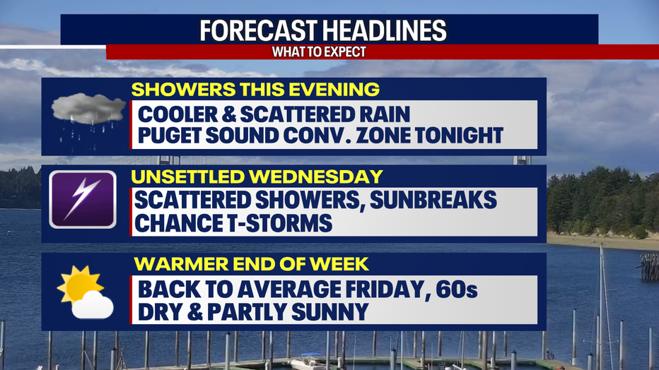
Seattle weather: Showers, sunbreaks and possible storm Wednesday
SEATTLE - Tuesday has been a cooler day with more clouds and plenty of rain showers. A few sunbreaks this afternoon along the coast and in the South Sound.
Headlines TONIGHT (FOX 13 Seattle)
Highs have been a good 5-15 degrees cooler today compared to Monday. Temperatures reached the upper 50s to low 60s.
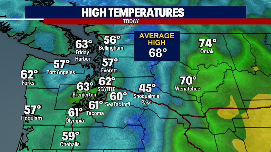
TODAY HIGH TEMP
Overnight, we will see more clouds with a few scattered showers. Lows will be cooler, back in the low to mid 40s.
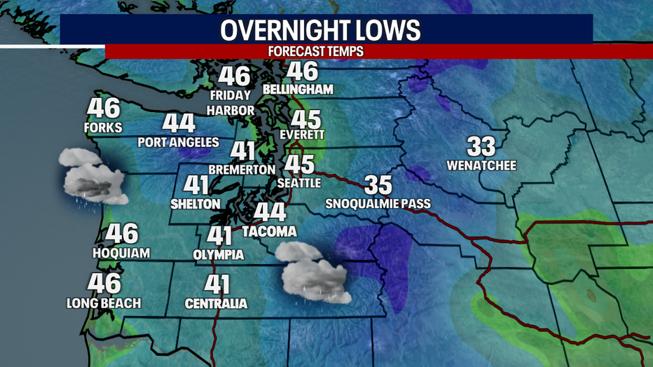
Regional Overnight Lows (FOX 13 Seattle)
Wednesday will start with mostly cloudy skies and scattered showers.
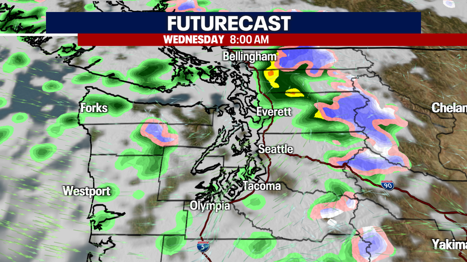
FUTURECAST NEXT 48 HOURS
Highs will be slightly warmer on Wednesday, back into the low 60s. Winds will be a bit breezy in the afternoon, gusts up to 25 mph.
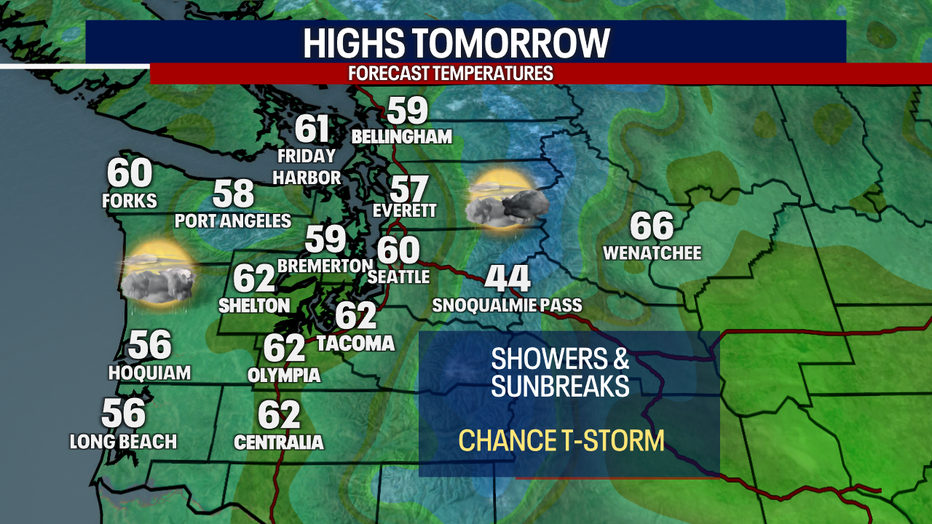
Regional Highs Tomorrow
Showers will be spotty in the afternoon with more sunbreaks. There will be a Puget Sound Convergence Zone on Wednesday evening around the central Puget Sound. There is also the potential for afternoon t-storms, bringing heavier rain bursts, gusty winds and small hail.
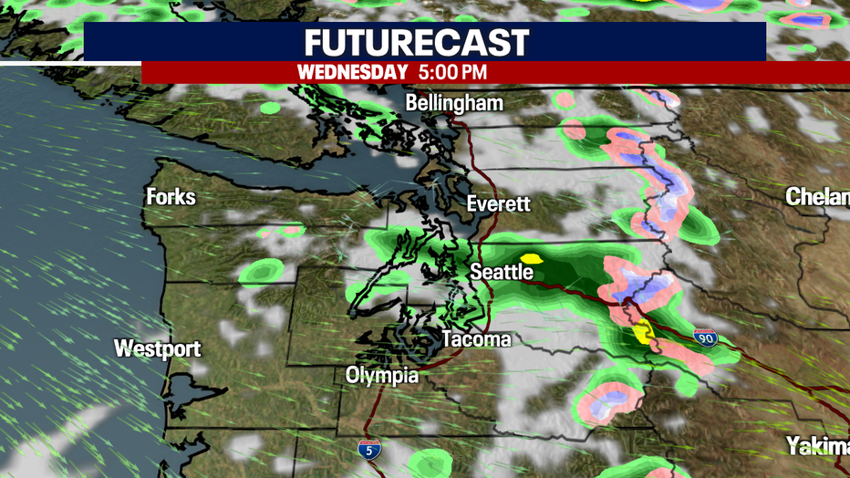
FUTURECAST 5PM
Skies will start to dry out Thursday with slightly warmer temperatures as high pressure starts to build back into the area. The nicest day of the extended forecast is Friday, with highs around seasonal average. Showers will increase as early as Saturday, with more rain and clouds to end the weekend into early next week.
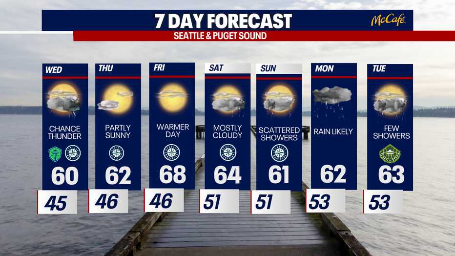
7 DAY FORECAST